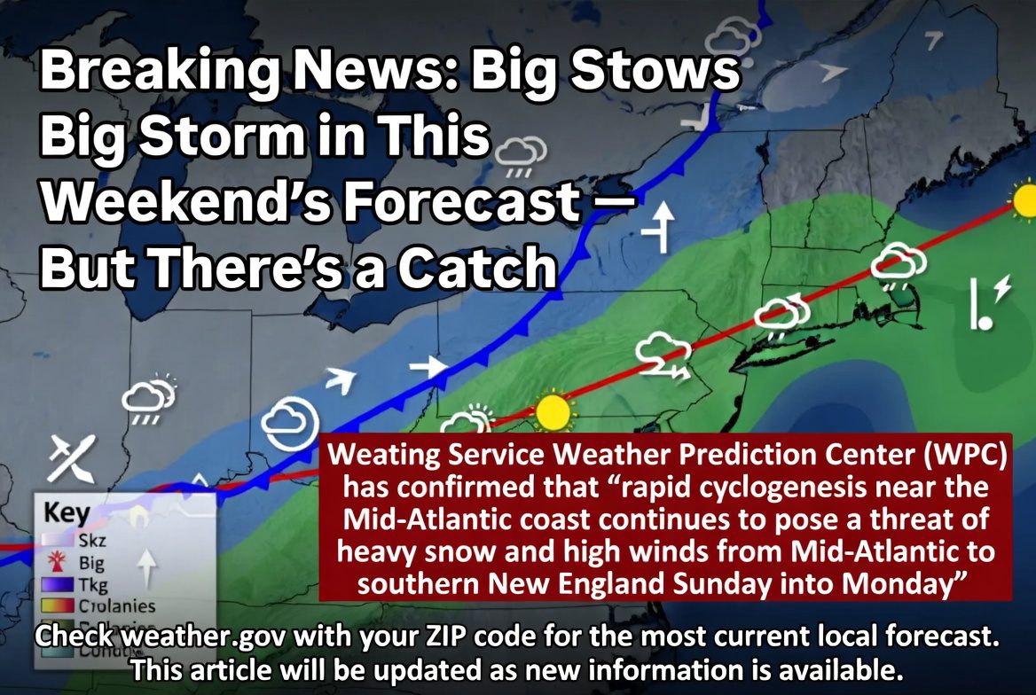
Big Storm in This Weekend’s Forecast — But There’s a Catch
A nor’easter — possibly a bomb cyclone — could slam the Northeast from D.C. to Boston starting Sunday. The catch: a 100-mile track difference separates ‘major storm’ from ‘nothing at all’
| LIVE FORECAST ADVISORY (as of February 19, 2026, 3:16 PM EST): The National Weather Service Weather Prediction Center (WPC) has confirmed that ‘rapid cyclogenesis near the Mid-Atlantic coast continues to pose a threat of heavy snow and high winds from Mid-Atlantic to southern New England Sunday into Monday.’ Check weather.gov with your ZIP code for the most current local forecast. This article will be updated as new information is available. |
1. The One-Minute Summary: What We Know Right Now
|
That phrase — ‘there’s a catch’ — deserves unpacking. Meteorologists are confident a storm will develop. What they don’t yet know is exactly where. And in Northeast winter storm forecasting, ‘exactly where’ is everything.
A storm that tracks 100 miles closer to the coast could bury New York City in a foot of snow. The same storm shifted 100 miles offshore could mean nothing more than a cloudy Sunday. The models haven’t agreed. That disagreement is the story.
| Key Detail | As of February 19, 2026 |
| Storm Type | Potential nor’easter; possible bomb cyclone |
| Primary Development Window | Sunday, February 22 — off Mid-Atlantic coast |
| Impacts | Heavy snow, gusty winds, coastal flooding (if track is close enough) |
| Most Affected Area (if close track) | Mid-Atlantic to southern New England: D.C., Philadelphia, NYC, Boston |
| Duration | Sunday afternoon through Monday |
| Track Uncertainty | High — 100–200 miles separates heavy snow from no impacts |
| Forecast Confidence Improves | Friday and Saturday (1–2 days before storm) |
| Source | NWS Weather Prediction Center, WPC Extended Discussion, Feb. 19 3:16 PM EST |
2. The Catch: Why This Forecast Is So Uncertain
Forecasting a Northeast winter storm is famously difficult. More so than almost any other type of weather. And the reason is geography: the East Coast sits at the convergence zone of cold Arctic air from the north and warm, moist Atlantic air from the south. When those two air masses meet along the coast, storms can intensify rapidly — sometimes to explosive effect. But the exact location of that meeting point is extraordinarily sensitive.
The 100-Mile Problem
Here’s how meteorologists at CNN Weather explained it on February 19:
“A change of just 100 or 200 miles could be the difference between big cities in the Northeast seeing a full-fledged nor’easter that packs significant snow and strong winds, or a storm that just brings light snow that maybe slows travel.” — CNN Weather, February 19, 2026
One hundred miles sounds like a lot. In weather terms, it is not. Storms routinely drift 50 to 100 miles from where models initially place them, especially when they haven’t formed yet. This storm doesn’t even begin to develop until Sunday. That’s two and a half days from now. That’s why the forecast uncertainty is this high.
The Late January Comparison
This isn’t a new problem. It happened to this same region just four weeks ago. In late January, multiple computer models showed a major winter storm hitting all of the Northeast. The system arrived — but stayed offshore, only scraping southeast New England. The rest of the coast got little or nothing.
The same models now showing a potential major nor’easter for this weekend are the same models that missed the late January track. Forecasters are appropriately cautious. That caution is the right call.
The Technical Issue: Rapid Cyclogenesis
The National Weather Service’s Weather Prediction Center specifically flagged a technical challenge in its February 19 discussion: the storm will undergo ‘rapid cyclogenesis’ — a fast-intensifying development pattern. The exact behavior of the upper-level atmosphere during that intensification phase is still uncertain, particularly in the planetary boundary layer (PBL). Translation: even small differences in how the storm develops in its early hours could shift the entire track.
WPC Official Statement (Feb. 19, 3:16 PM EST): “Variability in totals from run to run will be found in guidance the next few days given the uncertainty of the mid and upper level evolution, as well as the behavior of the temperatures within the PBL leading into the expected evolution. A lot to monitor in this setup.”
3. The Three Scenarios Forecasters Are Watching
Rather than giving you a single prediction, meteorologists are presenting three scenarios — each tied to a different storm track. Here they are, based on CNN Weather’s analysis from February 19:
Scenario 1: Moderate Impacts Along the Coast (Most Likely)
| Most likely scenario as of February 19, 2026. A storm develops moderately close to the coast, bringing meaningful but manageable snow — enough to slow travel — to coastal areas from the mid-Atlantic through southern New England. Gusty winds and some coastal flooding are possible. Interior Northeast and Great Lakes could also see some snow. Not a historic storm, but a real one. |
Scenario 2: Major Nor’easter from D.C. to Boston (Possible, Less Likely)
| Possible but currently considered less likely than Scenario 1. A powerful storm develops close enough to the coast to deliver major impacts from Washington, D.C., to New York and Boston. Heavy snow — potentially significant accumulation — and strong winds would make travel very difficult Sunday afternoon through Monday. Higher potential for significant coastal flooding and beach erosion. Some computer model runs support this scenario. |
Scenario 3: Storm Goes Offshore — No Impacts (Least Likely)
| Currently the least likely outcome. The storm tracks far enough offshore that it brings no meaningful impacts to the coast. Models still occasionally produce this solution, but it’s not the dominant signal. |
| Scenario | What Happens | Likelihood |
| 1: Moderate Coastal Impact | Manageable snow + wind from DC to New England; travel slowdowns | Most Likely (Feb. 19) |
| 2: Major Nor’easter | Heavy snow + strong winds D.C. to Boston; difficult travel Sun–Mon; coastal flooding | Less Likely — possible |
| 3: Goes Offshore | Little to no impacts along the coast | Least Likely |
These likelihoods will shift significantly over the next 24–48 hours as the storm begins to form and model guidance converges. Friday and Saturday will be the critical windows for updated forecasts.
4. Who Is Most at Risk — and Who Probably Dodges It
Geography matters enormously for this storm. Here’s what different areas should be watching for, based on current forecasting:
Highest Risk Zone: Mid-Atlantic Coast to Southern New England
- Washington, D.C.: Heavy snow possible in Scenarios 1 and 2; storm-force winds in Scenario 2
- Philadelphia: Snow likely; accumulation depends on track; Scenario 2 brings major impacts
- New York City: Similar to Philadelphia; major impacts only if storm tracks close to shore
- Boston: Snow likely in Scenarios 1 and 2; the farther offshore the storm, the less impact
- Coastal areas (Jersey Shore, Cape Cod, Outer Banks): Coastal flooding risk in Scenario 2
Moderate Risk: Interior Northeast and Great Lakes
- Interior New England, upstate New York, Great Lakes region: Some snow expected regardless of coastal track; manageable impacts
- Washington, D.C. suburbs and inland mid-Atlantic: Range of outcomes; watch for updates
Lower Risk: Southeast and South
The Southeast will feel the storm’s aftermath differently. After the system passes, the NWS is forecasting highs 10 to 20 degrees below late February averages from the Deep South to the Ohio Valley by Monday — a cold air mass following the departing nor’easter.
West Coast: Separate Storm System
The East Coast storm is not the only major weather event this weekend. A separate, slow-moving Pacific storm is expected to deliver heavy rain to Northern California and Western Oregon beginning Sunday. The NWS Weather Prediction Center described the potential for an ‘atmospheric river event Sunday into Monday’ with several inches of rainfall and heavy mountain snow possible.
5. What Is a Bomb Cyclone? (And Why It Matters Here)
|
Why does ‘bomb cyclone’ matter? Because it’s not just meteorological jargon. When a storm deepens that fast, it means:
- Wind speeds increase dramatically and quickly
- Snowfall rates can surge to 2–3 inches per hour in some locations
- Coastal flooding risk rises sharply
- Travel conditions can deteriorate faster than forecasters predict
The January 2026 nor’easter — Winter Storm Fern — underwent similar rapid intensification and caused over $4 billion in damage, the largest number of counties under winter storm warnings since at least 2008, and more than 9,000 cancelled flights on January 25 alone. This weekend’s system isn’t forecast to be that severe, but the potential mechanisms are similar.
6. The Winter That Was: Context for This Storm
To understand why this storm feels significant, you need to know what kind of winter the Northeast has already had.
An Already-Active Winter Season
New York City entered February having recorded just over 21 inches of snow for the season — versus a typical 14 inches by that point. Philadelphia was at nearly 16 inches against an average of a little over 10. Washington, D.C. and Boston both carried above-average totals.
The season featured two significant systems in quick succession: Winter Storm Fern in late January (a catastrophic storm from Texas to Maine that caused $4+ billion in damages), and a bomb cyclone that hit the Southeast and Carolinas at the start of February. This would be the third major system in roughly four weeks.
February Is ‘Prime Time’ for Nor’easters
The atmospheric conditions for Northeast storms peak in mid-to-late winter. Ocean surface temperatures stay cold, providing fuel for coastal storm development. Cold Arctic air digs down from Canada more consistently. And storm track patterns align more favorably for coastal development.
CNN Meteorologist Analysis (Feb. 10, 2026): “February is primetime for big Northeast snowstorms.” Two storms earlier this winter have already shown what happens when conditions are ripe — and they were. The current pattern suggests a third bite at the apple is possible.
The Colorado River Basin Water Crisis Context
The West Coast storm has its own significance beyond the immediate flooding risk. AccuWeather Senior Meteorologist Brett Anderson noted in February that snowpack in Colorado and Utah was near record-minimum levels heading into mid-February. The Colorado River basin serves approximately 40 million people. The incoming Pacific storm series may help, but the deficit is severe.
7. What the Computer Models Are Saying
Meteorologists rely on two primary global forecast models: the American GFS (Global Forecast System) and the European ECMWF (European Centre for Medium-Range Weather Forecasts). For Northeast storms, the European model has historically outperformed the American model — most famously during Hurricane Sandy in 2012.
Why Models Disagree Right Now
As of February 19, the models show different tracks for the storm’s development Sunday. Some runs favor a closer coastal track (Scenario 2). Others favor a track that stays offshore enough to limit impacts (Scenario 1 or 3). Model ensemble guidance — which averages many model runs together — currently leans toward Scenario 1 as the most likely outcome.
The key variable: the behavior of an upper-level trough across the southern Atlantic Seaboard. How quickly and how deeply it amplifies will determine whether the surface low forms close enough to the coast to deliver major impacts.
When Will We Know More?
Forecast confidence will improve substantially on Friday and Saturday, February 20–21. By Saturday, models should converge enough to give a clear picture of whether this is a major storm, a minor storm, or a no-show. If you’re planning weekend activities in the Northeast, check Saturday morning’s forecast before making final decisions.
Bottom Line From CNN Weather: “This level of track uncertainty is common days ahead of a possible East Coast storm, so it’s best to keep checking back daily until the forecast becomes clearer.”
8. What to Do Right Now to Prepare
You don’t need to panic. But you should prepare intelligently — which means not waiting until Saturday afternoon when store shelves are cleared out and forecasters finally have certainty.
Check Your Local Forecast — Today
- Go to weather.gov and enter your ZIP code
- Look for any existing Winter Storm Watches or Advisories — these will appear if NWS offices have issued them
- Download your local NWS office’s forecast discussion — it’s written for meteorologists but explains the uncertainty directly
- Set up weather alerts on your phone for your location
Prepare Your Home and Vehicle This Week
- Check your snow shovel, ice melt, and sidewalk salt supply — do it before Friday
- Fill your car with gas now — gas stations see lines before major storms
- Check wiper blades and tire pressure — cold weather drops tire pressure
- Stock one to two days of groceries — not a month of supplies, just a few extra days
- Know where your flashlights and extra batteries are
If You Have Travel Planned for Sunday or Monday
This is the most important practical advice in this article. If you have flights, trains, or long drives planned for Sunday or Monday — especially if you’re traveling along the I-95 corridor from D.C. to Boston — keep an eye on airline change policies.
- Many airlines allow free flight changes when weather watches or warnings are issued
- Watches and warnings will likely be issued Friday or Saturday if the forecast firms up toward Scenario 2
- Amtrak may reduce service or cancel trains on the Northeast Corridor
- Check the status before leaving for the airport — not after you arrive
If You’re in a Coastal Area
- Review your flood zone status at msc.fema.gov
- Know your evacuation routes if you’re in a low-lying coastal area
- Move vehicles away from low-lying flood-prone streets before Sunday morning
9. Frequently Asked Questions (FAQ)
Is a big storm coming this weekend?
Possibly. A storm is expected to develop off the Mid-Atlantic coast on Sunday, February 22. Whether it delivers major impacts or minimal ones depends on its exact track — a 100-to-200-mile difference the computer models haven’t yet resolved. Meteorologists expect clearer answers by Friday or Saturday.
Will it snow in New York City this weekend?
New York City is within the potential impact zone. Under the most likely scenario, the city could see manageable snow that slows travel. Under the major nor’easter scenario, heavy snow and strong winds are possible from Sunday afternoon through Monday. Confidence in the forecast will improve significantly by Saturday.
What is a nor’easter?
A nor’easter is a type of storm along the East Coast of North America characterized by strong winds blowing from the northeast, often bringing heavy snow, rain, and coastal flooding. They typically form when cold air from Canada collides with warm, moist Atlantic air. The name comes from the direction of the dominant winds, not the storm’s origin.
What is a bomb cyclone?
A bomb cyclone (also called ‘explosive cyclogenesis’) is a storm whose central pressure drops at least 24 millibars in 24 hours. This rapid deepening intensifies wind speeds, snowfall rates, and storm severity dramatically. The current storm could reach bomb cyclone intensity if it tracks close enough to the coast and undergoes rapid development Monday.
When should I check for an updated forecast?
Friday afternoon and Saturday morning are the critical windows. By then, the models should converge on the storm’s track. Check weather.gov with your ZIP code, and watch for NWS Winter Storm Watches or Warnings being issued for your area — those are the official signals that a major event is likely.
What parts of the country are at risk?
The primary risk zone for the potential nor’easter is the Mid-Atlantic to southern New England — from Washington, D.C., through Philadelphia, New York City, and Boston. The interior Northeast and Great Lakes regions face some snow risk regardless of the coastal track. Separately, Northern California and Western Oregon face heavy rain and mountain snow from a Pacific storm system this weekend.
How does this storm compare to the January 2026 Winter Storm Fern?
Winter Storm Fern in late January 2026 was an unusually large and destructive storm that caused $4+ billion in damage and set a record for the number of counties simultaneously under winter storm warnings (since at least 2008). The current storm is not currently forecast to be on that scale — but if it develops as a major nor’easter along the coast (Scenario 2), it could deliver significant impacts to densely populated Northeast cities.
What’s happening on the West Coast this weekend?
A separate, slow-moving Pacific storm system will bring heavy rain to Northern California and heavy mountain snow to the Sierra Nevada and Cascades, beginning Sunday. AccuWeather described the storm series as potentially delivering ‘close to an entire month’s worth of rain and snow’ to parts of California. This is significant given near-record-low snowpack in Colorado and Utah that has raised concerns about Colorado River water supplies for summer.
10. Key Takeaways and Where to Get Updates
- A potentially major nor’easter is forming for Sunday, February 22 — the NWS Weather Prediction Center has flagged ‘rapid cyclogenesis near the Mid-Atlantic coast’ as a distinct threat for heavy snow and high winds from the Mid-Atlantic to southern New England.
- The ‘catch’: storm track models disagree by 100–200 miles. That difference is the deciding factor between a major winter event and a modest inconvenience.
- Most likely scenario: Manageable snow along the coast, manageable travel slowdowns. Possible scenario: A full nor’easter from D.C. to Boston with heavy snow and coastal flooding. Least likely: Storm goes offshore with no impacts.
- The storm could strengthen into a bomb cyclone Monday if it tracks close to the coast.
- Forecast confidence will improve dramatically by Friday afternoon and Saturday morning. That is the time to make final decisions about weekend travel.
- The Northeast has already exceeded seasonal snowfall averages following Winter Storm Fern and the early February bomb cyclone. This is the third major system in four weeks.
- Separately, heavy rain and mountain snow are expected in California and the Pacific Northwest from a different storm system this weekend.
Where to Get the Most Up-to-Date Forecast
- gov — Enter your ZIP code for official NWS local forecasts and any active warnings
- NWS Weather Prediction Center (wpc.ncep.noaa.gov) — Official extended forecast discussions updated multiple times daily
- com — Real-time storm tracker and neighborhood-level forecasts
- CNN Weather (cnn.com/weather) — Scenario-based coverage of Northeast storm uncertainty
- The Washington Post Capital Weather Gang — Detailed mid-Atlantic forecasting
Sources
- National Weather Service Weather Prediction Center: Extended Forecast Discussion, February 19, 2026, 3:16 PM EST
- CNN Weather: ‘A big snowstorm could hit the East Coast this weekend — or not. Here are the scenarios,’ February 19, 2026
- The Washington Post: ‘A strong nor’easter could soon hit the East Coast,’ February 19, 2026
- AccuWeather: ‘More big storms heading for California, US West starting in mid-February,’ February 11–13, 2026
- CNN Weather: ‘It’s been a brutal winter, but now it’s prime time for blockbuster Northeast storms,’ February 10, 2026
- Wikipedia: January 23–27, 2026 North American winter storm (Winter Storm Fern)
| About This Article
This article was researched using official NWS Weather Prediction Center forecast discussions (February 19, 2026), CNN Weather coverage, The Washington Post Capital Weather Gang, AccuWeather, and the NWS Storm Prediction Center Day 4–8 Convective Outlook. All forecast scenarios reflect published meteorologist analysis as of 3:16 PM EST February 19, 2026. Weather forecasts are inherently uncertain and change rapidly — check weather.gov for the most current information. This article will be updated as forecast confidence improves. Published: February 19, 2026. |
Discover more from MatterDigest
Subscribe to get the latest posts sent to your email.